Accelerate Seagrass is a collaborative program being delivered by Climate Impact Partners, Deloitte, Project Seagrass, and the National Oceanography Centre which aims to support groundbreaking research into seagrass carbon sequestration and unlock long-term finance to save and reinstate vital seagrass meadows.
Part of this programme of work includes mapping to record the presence and extent of Scotland’s seagrass meadows (vital data to inform the protection and conservation of seagrass meadows and the benefits they provide).
In autumn 2025, members of our Scotland team were out in the field carrying out drone surveys in Drum Sands. In this blog post, our Project Seagrass interns, Ewan Garvey and Jasper Brown discuss the work undertaken:
1.Preparing to Monitor
Prior to the commencement of drone work, site assessments were conducted. These checked for air restrictions, site accessibility, and permissions required to access land.
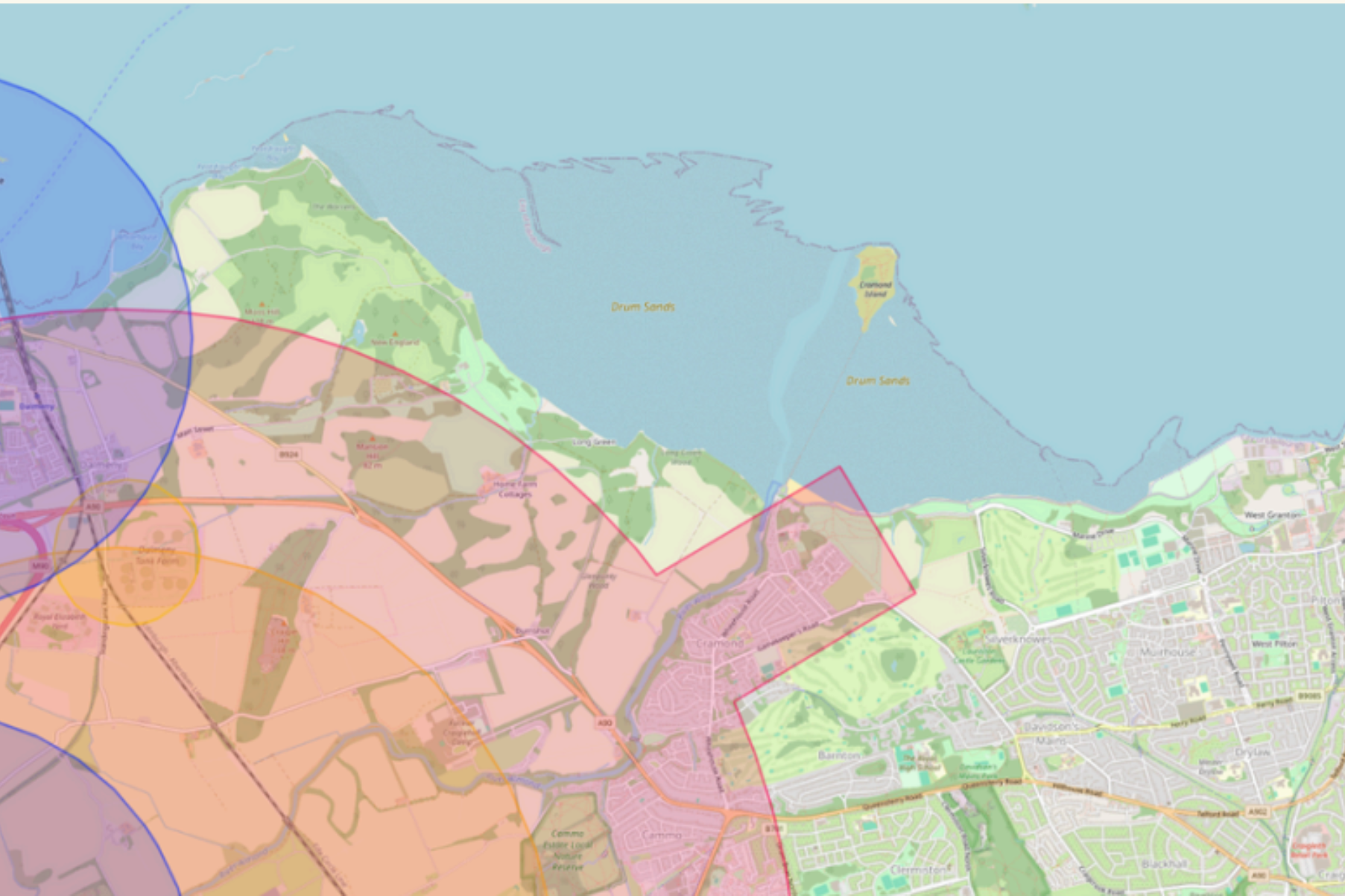
Drum Sands (see below map), is a site we have recently mapped and is located within a private estate, requiring permission for access to get to and work on site.
This site is located just outside of Edinburgh airport’s no fly zone, a restricted air space which must be kept clear of, at all times.
2. On Site
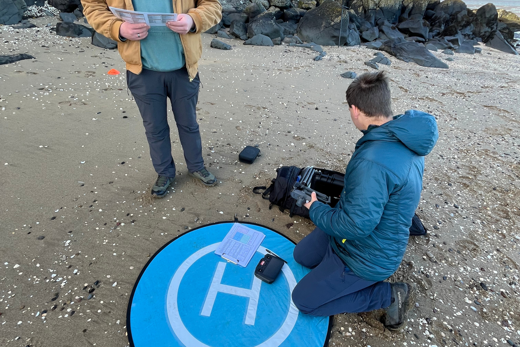
After arriving at the site, we had to transport the kit and get it set up for flying, This included: a Differential Global Positioning System (DGPS), Ground Control Points (GCP’s) and the drone itself.
The DGPS is a device which communicates with satellites and allows for extremely accurate spatial referencing of points, down to 3cm variance. The benefits of this system are to allow you to return to the exact location for continuous monitoring.
GCP’s were positioned along the sample area. These are large checkered squares which are easily identifiable from the air. The exact locations are taken using the DGPS, to allow for the drone images to be synced to monitoring data.
The drone was set up following our pre-flight checklist, ensuring the batteries, cameras, and propellors, were all in working condition.
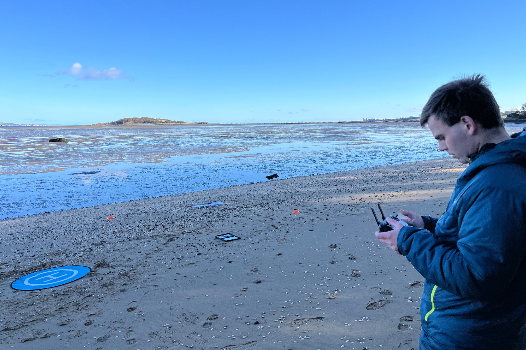
3. Flying
Once the drone had been launched and was in the air, the operator or another team member had to maintain line of sight with the drone at all times. This was to ensure the safety of others and the drone.
At Burntisland, another of our sites, this was extremely important, as there is a railway line which runs adjacent to the seagrass meadow. We were given explicit instructions from Network Rail not to fly above the railway line, to avoid any disruptions to their services.
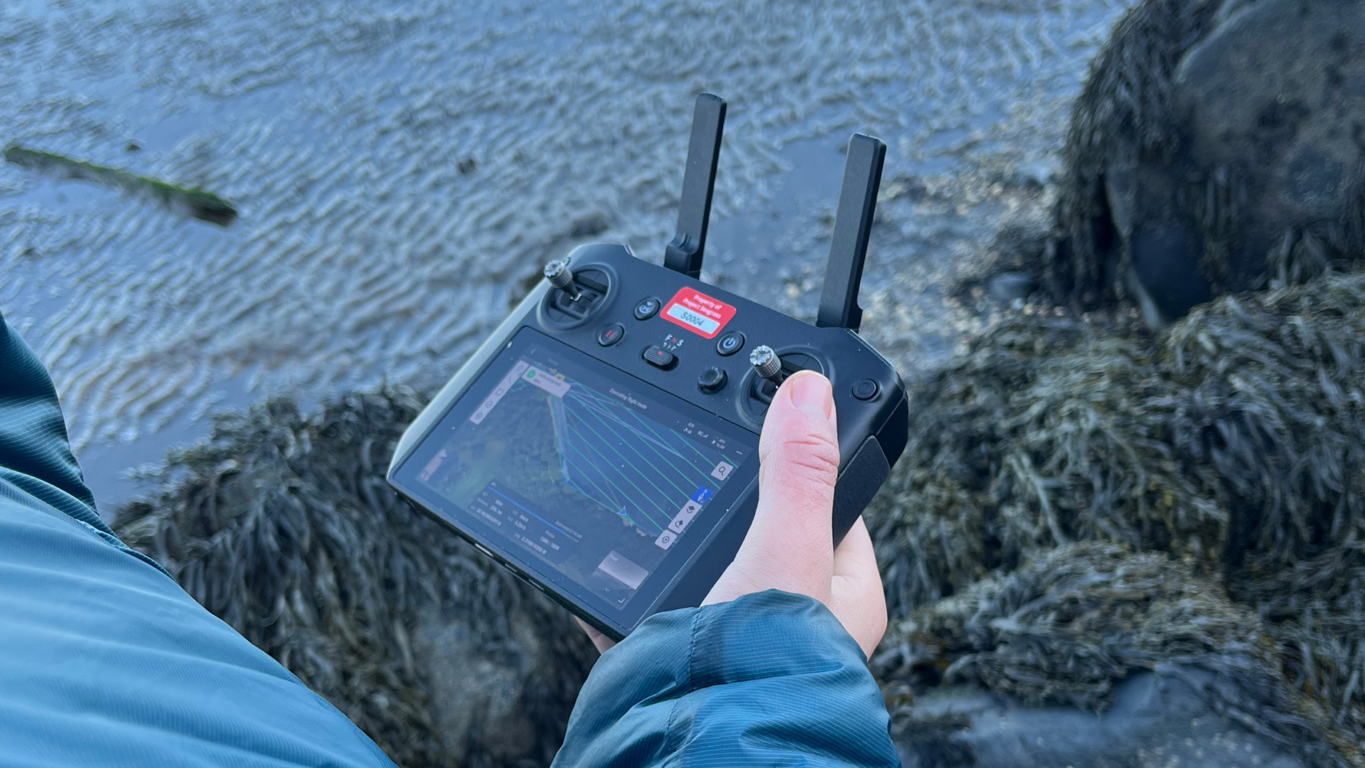
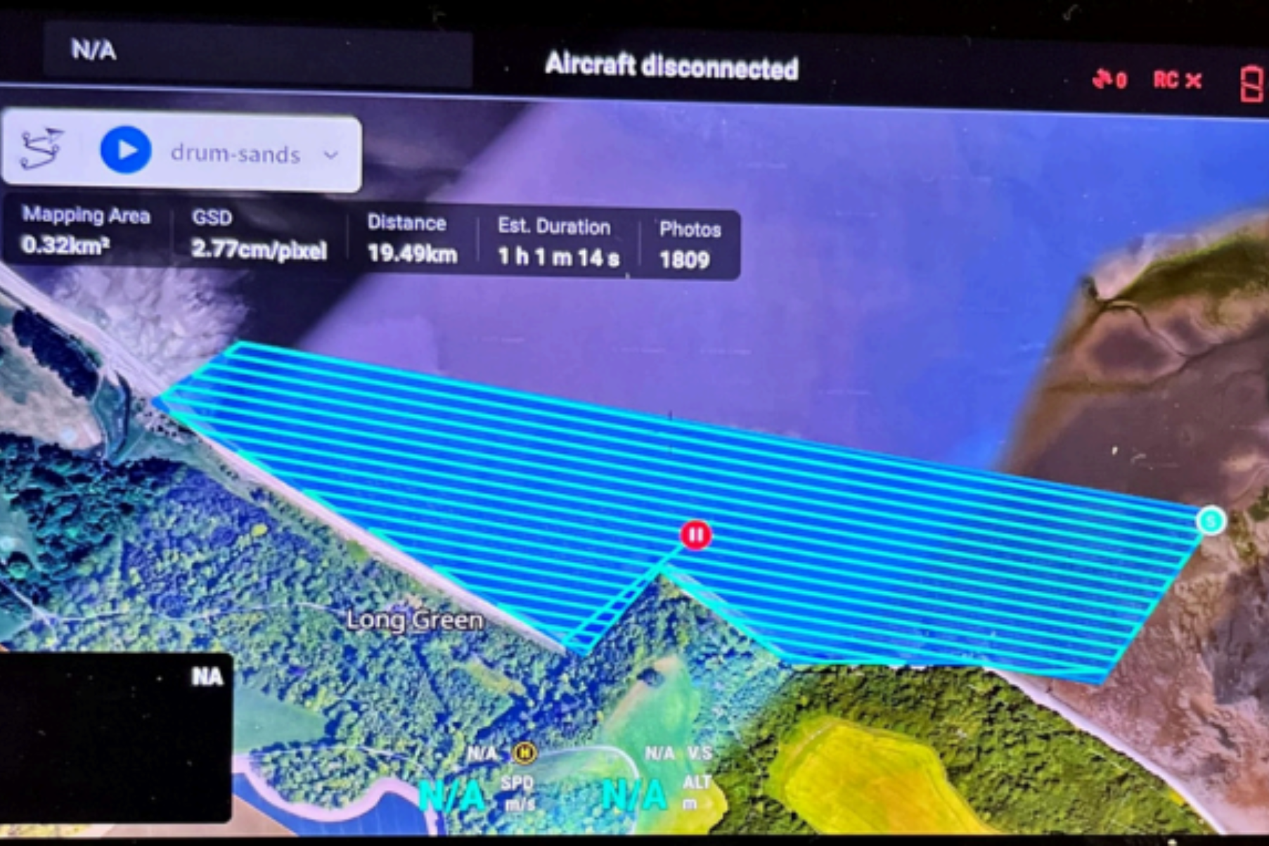
Using a pre-programmed flight plan (below) the drone was set on course, taking images with a 75% overlap between images.
The flight height was fixed at 60m. This was chosen to provide adequate clearance from the tops of trees and to increase the field of view.
Once the flight plan was complete, we checked the images to ensure that the entire area we needed had been surveyed.
4. Challenges
One of the biggest hurdles we faced during this drone work was weather; for good quality drone work to take place there must be clear, dry skies with low wind speeds. This was particularly inconvenient for us, as during our planned drone flights at Drum Sands, there were strong winds and rain, which meant that we were unable to fly the drone.
Requesting for an extension of site access posed quite a challenge to do last minute but we managed to gain access to complete the work. While the drone was in flight the team had to keep vigilant for potential hazards such as
flying birds and members of the public.
We did this by having team members stationed along the sample locations. Each team member was provided with a radio to relay important information back to the pilot.
This also allowed us to interact with any interested members of the public whist keeping the drone in sight at all times.
5. Wrap up and final product
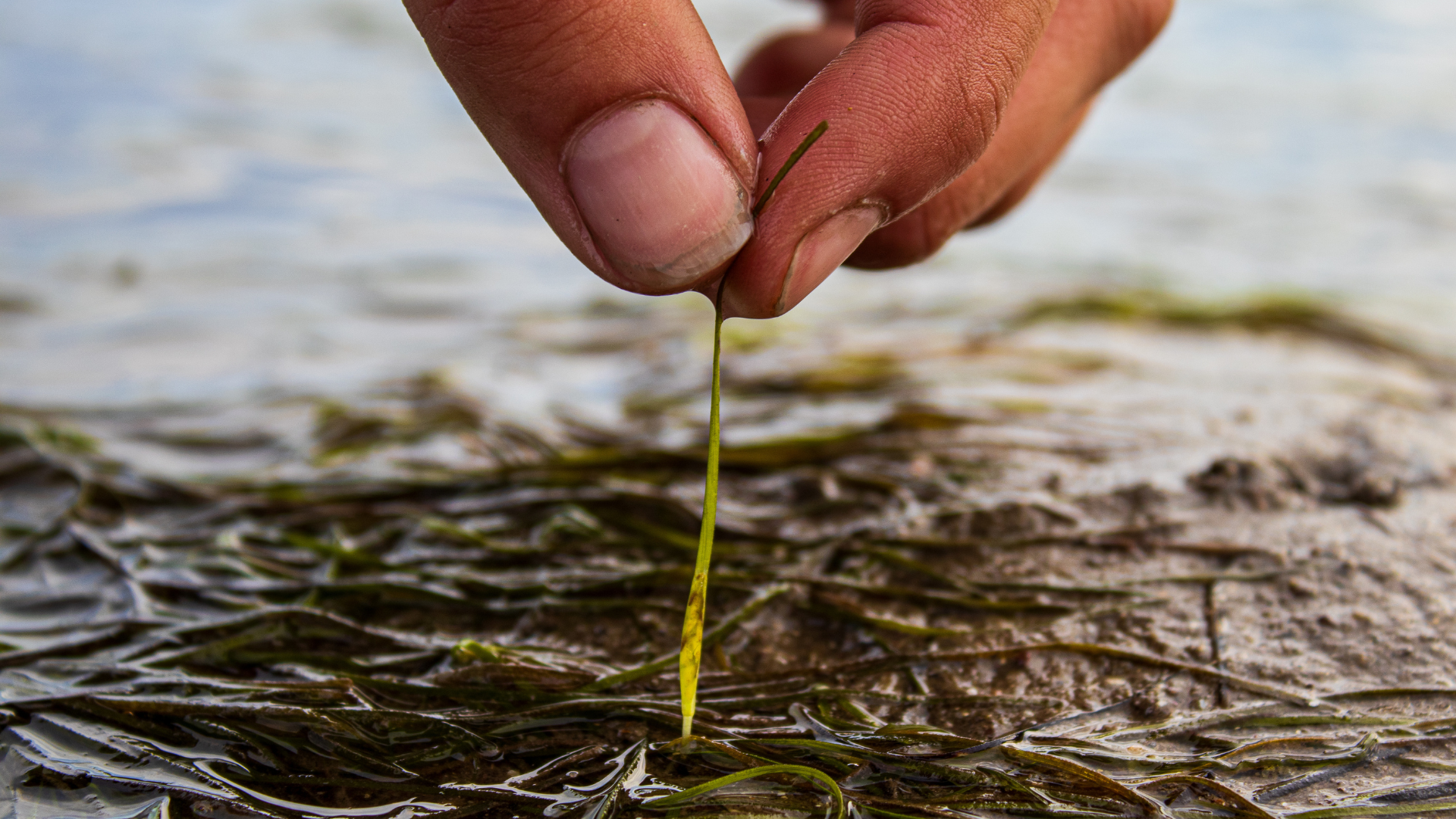
Once all the drone work had been completed, the images captured by the drone were exported and processed using specialised software, to remove the overlap between photos and to merge the separate images into one large map of the whole area.
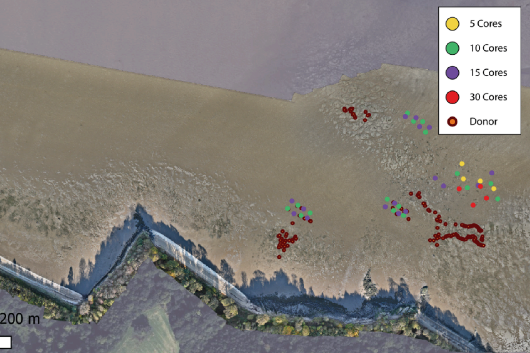
Using other data points gathered from the area we can overlap these and the image to create an easily understood map.
We used this method to create the map (see below) which shows Zostera noltii transplant and donor DGPS points, overlayed onto the drone footage we took of Drum Sands.