Tag: North Atlantic

A patch of seagrass fragments planted at Priory Bay, Isle of Wight.

Fragment Walk reflections

As our Fragment Walks from the 2025/26 season come to an end Project Seagrass Intern Anya Lamparelli reflects on this year’s efforts. A seagrass fragment is a precious and vulnerable thing. Torn free by winter storms and strong swells these delicate shoots with intricate root systems still attached wash ashore

Read More »
A sign with information about the Isle of Wight's seagrass meadows is attached to railings on the slipway at Seaview.

Seagrass signage installed in the Solent

Residents and visitors to the Isle of Wight can now access information about the Island’s important seagrass habitats thanks to new signage installed through support from Seacology. The signage has been installed by Project Seagrass as part of ongoing efforts to protect and restore seagrass ecosystems within the Solent. The signs

Read More »
Noltii leaf - Charles Bagshaw

Accelerate Seagrass: Exploring the process of site selection

Accelerate Seagrass is a collaborative program being delivered by Climate Impact Partners, Deloitte, Project Seagrass, and the National Oceanography Centre which aims to support groundbreaking research into seagrass carbon sequestration and unlock long-term finance to save and reinstate vital seagrass meadows.   Part of this programme of work involves collaborating with community groups across Scotland to develop knowledge

Read More »
Drone controller being used next to kelp bed

Accelerate Seagrass Drone Survey

Accelerate Seagrass is a collaborative program being delivered by Climate Impact Partners, Deloitte, Project Seagrass, and the National Oceanography Centre which aims to support groundbreaking research into seagrass carbon sequestration and unlock long-term finance to save and reinstate vital seagrass meadows.   Part of this programme of work includes mapping to record the presence and extent of

Read More »
A patch of seagrass fragments planted at Priory Bay, Isle of Wight.

Fragment Walk reflections

As our Fragment Walks from the 2025/26 season come to an end Project Seagrass Intern Anya Lamparelli reflects on this year’s efforts. A seagrass fragment is a precious and vulnerable thing. Torn free by winter storms and strong swells these delicate shoots with intricate root systems still attached wash ashore from subtidal seagrass meadows. If left stranded on the sand they will soon dry out, but on the Isle of Wight they are being given a second chance. Once a month at low tide, volunteers gather at Priory Bay, all eyes trained on the shoreline for a flash of green. Seagrass! Each fragment found is carefully collected and replanted into a growing community meadow. Since the initiative began three years ago 311 volunteers have joined the Project Seagrass team. Collecting 1,104 fragments over 16 fragment walks. 624 fragments have been replanted at Priory Bay, covering an area of 27 m2. Each month the volunteers revisit what they have already planted and monitor how the meadow is establishing, making field observations on what factors might be influencing its growth and survival. The remaining fragments have been replanted at the Seagrass Nursery in South West Wales; they will soon be used to support the team’s wider restoration work in the Solent. Fragment walks unfold under all conditions. Brilliant unbroken sunshine, pink sunsets, and cold grey mornings where the sky and sea blur into one. Yet the turnout remains steady, demonstrating the interest in and growing connection to seagrass meadows in the Solent. Many volunteers bring with them a deep lived knowledge of the coastline. They know how the beach shifts through the seasons, where sediment builds and erodes and when storms have reshaped the coast. This local insight has become an invaluable part of the project, helping guide where and how we replant seagrass. In turn, we can share our knowledge of ecosystem restoration and marine life. Creating a shared partnership where practitioners and locals learn from each other. Project Seagrass are working to restore 3.5 hectares of seagrass on the Isle of Wight as part of the Solent Seascape Project. Fragment walks allow us to trial new restoration methods while connecting with the local community. Thank you to every volunteer who has joined us in the Solent, we look forward to welcoming you back when the fragment walks restart in September 2026.

Read More »
A sign with information about the Isle of Wight's seagrass meadows is attached to railings on the slipway at Seaview.

Seagrass signage installed in the Solent

Residents and visitors to the Isle of Wight can now access information about the Island’s important seagrass habitats thanks to new signage installed through support from Seacology. The signage has been installed by Project Seagrass as part of ongoing efforts to protect and restore seagrass ecosystems within the Solent. The signs have been designed to raise awareness of seagrass meadows around the Isle of Wight in addition to highlighting ways that individuals can support these fragile ecosystems including through participation in Fragment Walks and uploading seagrass sightings to citizen science tool SeagrassSpotter. New seagrass signage installed at St Helen’s Duver Members of the Project Seagrass team installed new signage at locations on the Isle of Wight Two signs were installed in Seaview, the location of one of the Island’s extensive Zostera marina meadows and where Project Seagrass, Blue Parameters, and WarrenBoats have recently installed two Advanced Sustainable Mooring Systems (ASMS) to relieve pressure on the Island’s important seagrass habitats. A further sign has been installed at St Helens Duver, Priory Bay, the location of the start of our Fragment Walks and the site of one of our active restoration sites. Further poster versions of the signs will be installed at Ryde and other locations around the Island. Anouska Mendzil, Senior Science Officer at Project Seagrass and Swansea University said “The Isle of Wight is an UNESCO Biosphere Reserve, home to some of the most ecologically important marine and coastal habitats under threat – seagrass meadows.  Across the Isle of Wight, new information signs now share the story of seagrass restoration and conservation, an effort led by Project Seagrass and the collective power of local community action, to contribute and enhance ecosystem recovery.” Seagrass signage installed at Seaview slipway Signage installed on the Southern Water building at St Helen’s Project Seagrass is grateful for the generous support from Seacology for making the creation and installation of these seagrass signs possible. Project Seagrass is also thankful to our stakeholders for their continued support and permission to install the signage.

Read More »
Posidonia species of seagrass in tropical blue waters underwater

Hurricanes devastated Florida’s East Coast. Then seagrass made an unexpected comeback

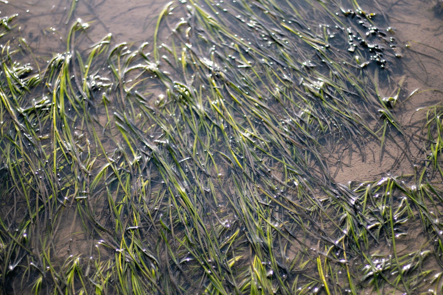
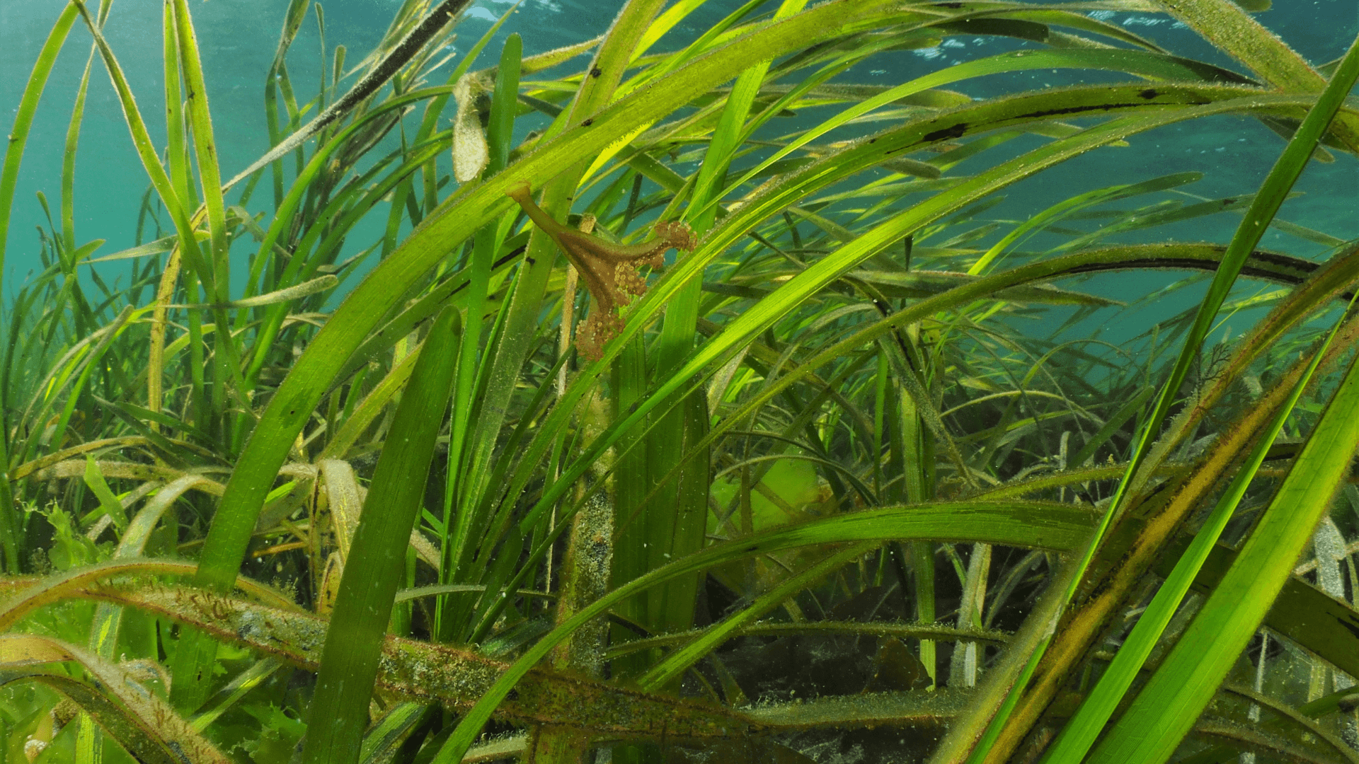
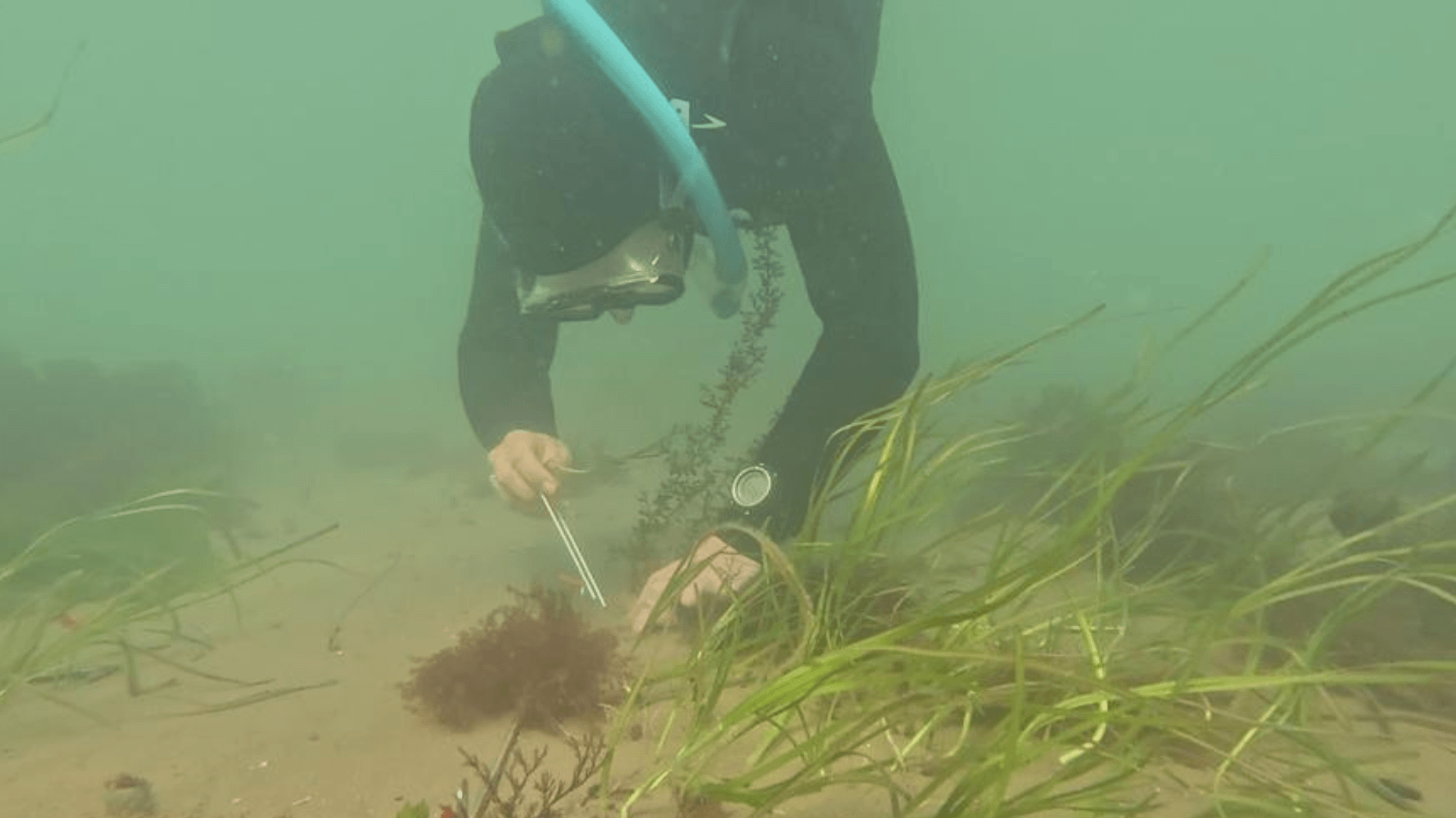
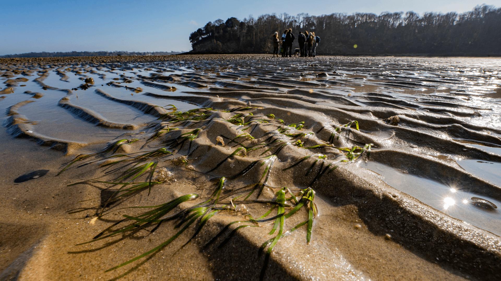
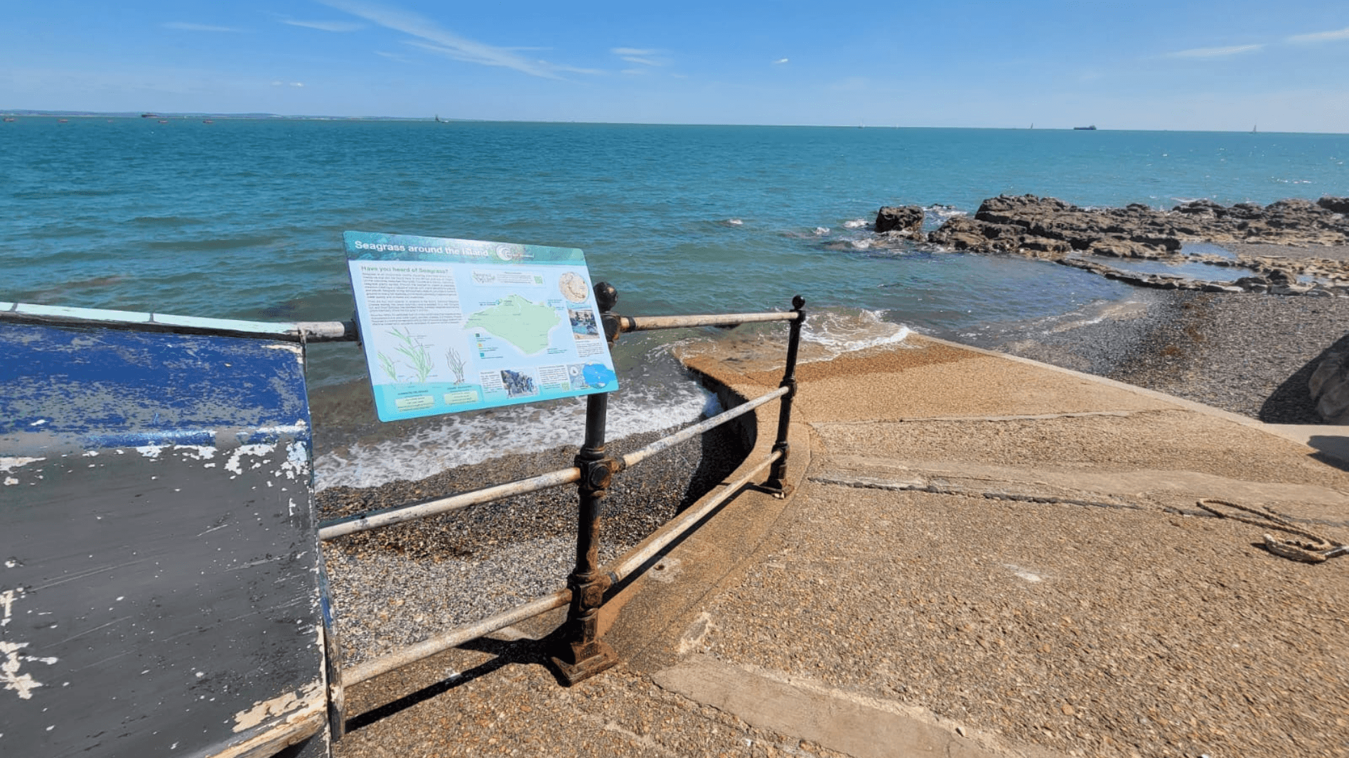
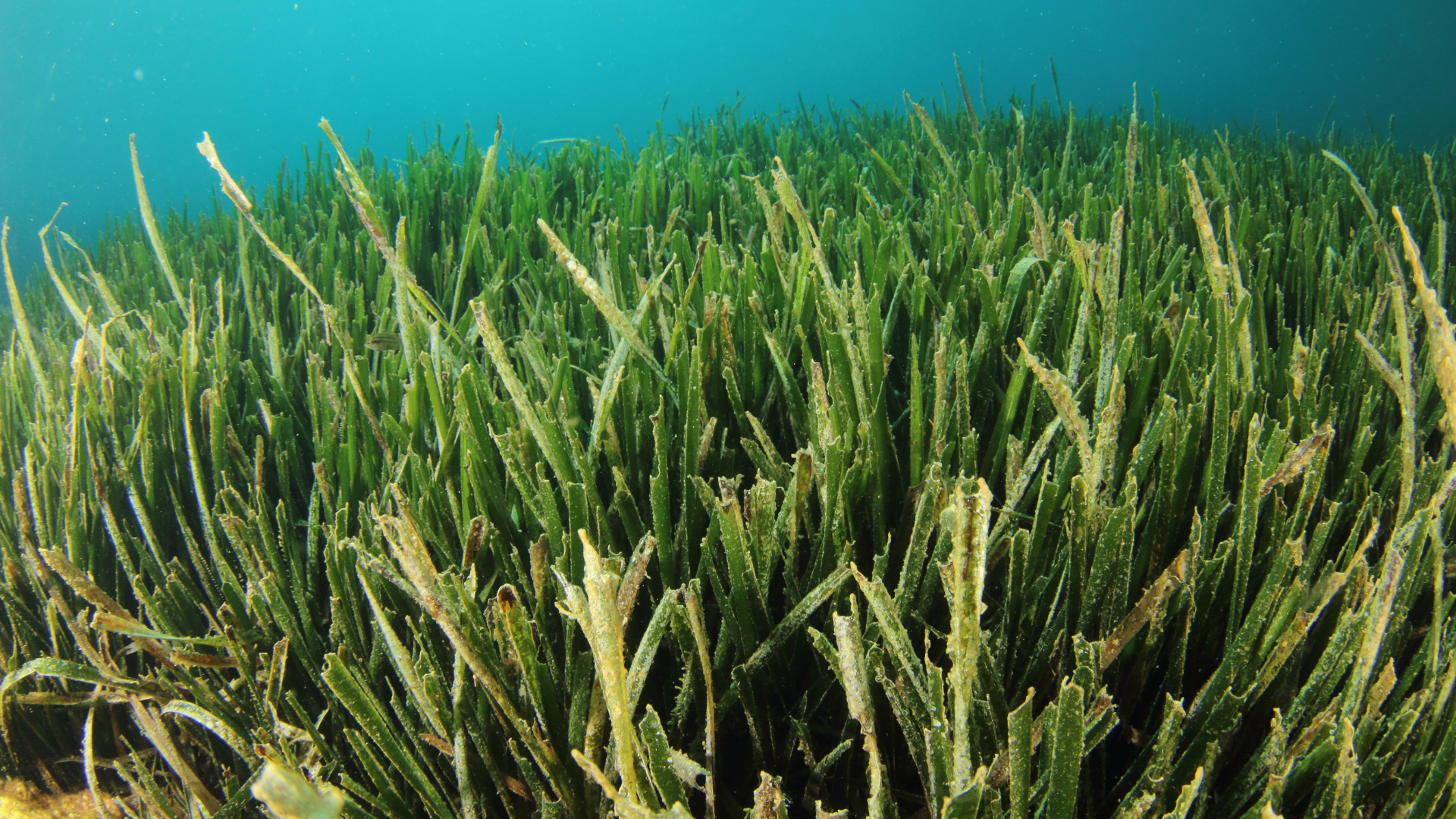
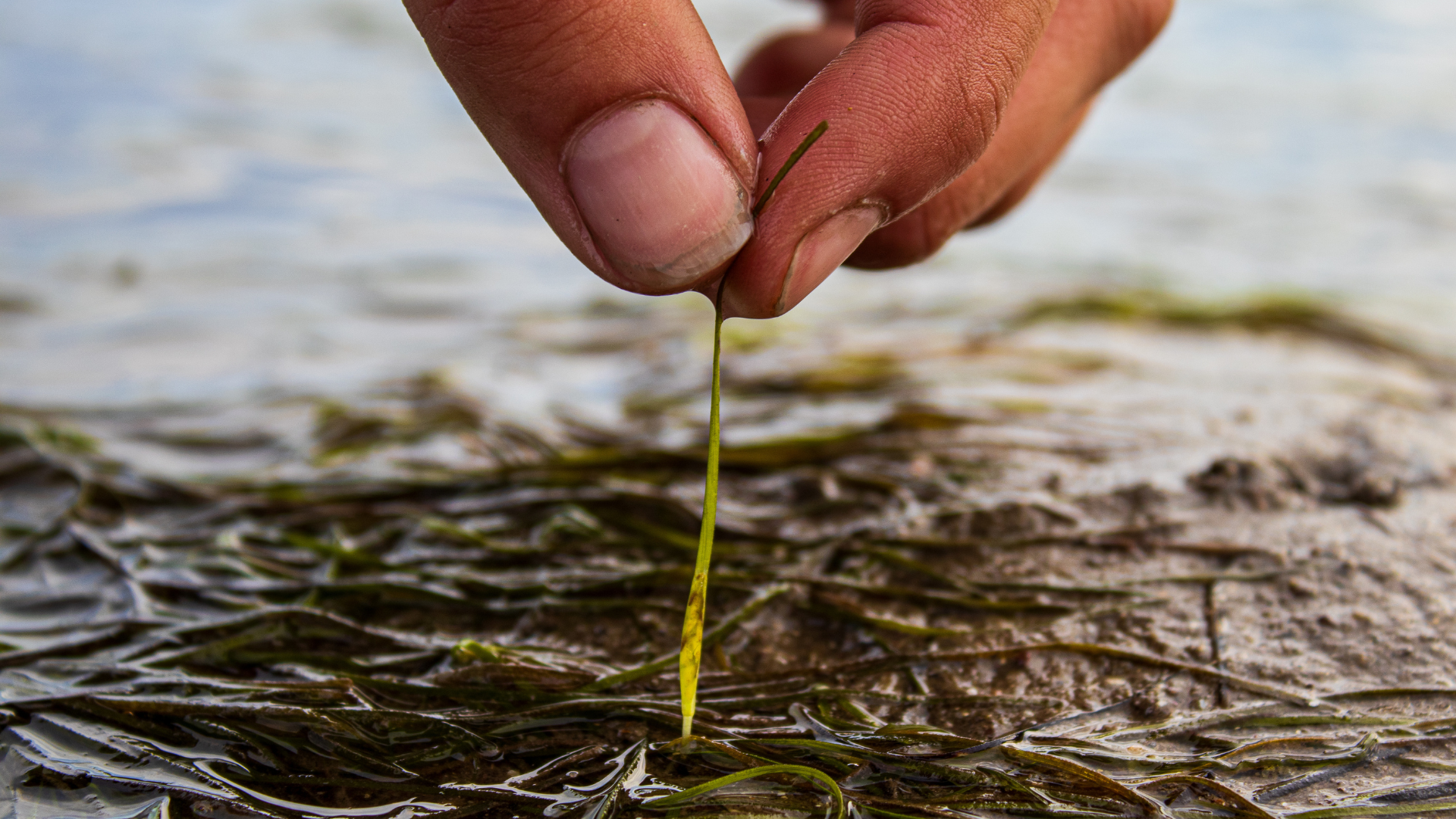
Hannah Harrero and Stephanie Insalaco-Wyner, geographers from Florida, comment on differing methods of monitoring the resilience of seagrass meadows in Florida’s ‘Mosquito Lagoon’, following a number of extreme weather events. Florida’s Indian River Lagoon has been an ecosystem in decline going back to 2011, when harmful algal blooms led to a severe decline in seagrass, the foundational component of shallow coastal ecosystems. Seagrass meadows stabilize sediments, improve water clarity and provide critical habitat and forage for species ranging from invertebrates to sea turtles and manatees. Seagrass also generates a significant amount of economic activity in the state of Florida. The loss of seagrass in the Indian River Lagoon System undermined fisheries, tourism and wildlife, ultimately leading to the starvation of more than 1,200 manatees from 2020-25, peaking in 2021-22. Mosquito Lagoon is part of the Indian River Lagoon system that spans 28 miles (45 kilometers), running from Cape Canaveral in the south up to Ponce Inlet in the north. As in the rest of the lagoon system, years of nutrient pollution and recurring algal blooms had diminished seagrass cover to nearly zero by the early 2020s. By most accounts, Mosquito Lagoon had crossed a critical ecological tipping point. In the fall of 2022, hurricanes Ian and Nicole struck Florida’s east coast within six weeks of one another, bringing intense rainfall, storm surges and coastal erosion. In the immediate aftermath, seagrass declined even further. But a few months later, in the spring of 2023, seagrass began to return. Satellite imagery revealed rapid and widespread regrowth. Hannah and I are geographers who study environmental change. Our research documents this unexpected recovery and examines what it may reveal about ecosystem resilience in heavily degraded coastal systems. One of us, Hannah Herrero, is a Volusia County native who grew up around the lagoon. She returned to her hometown at the outset of the COVID-19 pandemic. It was there that some local guides and fishermen she’d known for years suggested that our team should use satellite imagery to look at the state of collapse in the lagoon. The study we designed as a result used satellite imagery and machine learning, a type of artificial intelligence that uses advanced algorithms to learn and predict patterns, to track seagrass dynamics in Mosquito Lagoon before, during and after the storms. This approach allowed us to observe change at a scale and frequency that is difficult to achieve using only traditional field survey methods.   Florida Manatee Tracking seagrass from space Monitoring seagrass coverage “the old-fashioned way” involves going into the lagoon and laying out transects, straight lines that cut through a landscape, so standard observations could be recorded. We would then have to boat or wade all along those lines to measure seagrass extent and locations and create digital maps manually to show where it is present. As you can imagine, this is a time-intensive process that’s limited by how far you can boat or swim in a day, and by financial resources. So we decided to use satellite imagery instead. This method is not without its own challenges—water turbidity, or cloudiness, seasonal variability and the patchy nature of vegetation that grows on the bottom of the lagoon all make it difficult to observe seagrass growth directly on the imagery. To address this challenge, our study used imagery from NASA’s Harmonized Landsat–Sentinel program, which combines data from multiple satellites into a consistent record of photos of the same areas taken frequently over time. We analyzed imagery collected between September 2022 and January 2024, focusing on periods before and immediately after the hurricanes and throughout the subsequent recovery. We applied a type of machine learning model called Random Forest to classify each image into seagrass and nonseagrass categories. The machine learning algorithm is informed by training samples collected in the field, but once the model has learned the signature of seagrass, it is able to then apply the classification model to the rest of the lagoon and across time with limited human input. We can then validate this classification.   Heading into the field First, we had to train the model using hundreds of GPS points collected in the field over multiple seasons. This step helps to ensure that satellite classifications align with on-the-ground conditions and are accurately interpreting the images. Over several weeks during the summers of 2020 through 2023, our team spent many hours navigating Mosquito Lagoon in a small skiff designed for shallow depths, recording seagrass presence. It wasn’t always easy — Florida summers are intensely hot and humid, and Mosquito Lagoon definitely lived up to its name. But we got to see a wide variety of wildlife, including manatees, dolphins, sea turtles and alligators. And occasionally, on lucky days, we even spotted a roseate spoonbill or reddish egret. Our experience in the field highlighted why this system matters: Mosquito Lagoon is a remarkably vibrant place, teeming with wildlife. These long days on the lagoon, surrounded by its biodiversity and immersed in its unique sense of place, are what anchor the remote sensing data to on-the-ground ecological conditions and make the resulting models credible.   The authors wade into Mosquito Lagoon to track seagrass growth as they train their AI model. Captain William B. Wolfson, Grassroots Guide Service, New Smyrna Beach, FL What we found Our analysis reveals three distinct phases of seagrass coverage. First, seagrass declined sharply following hurricanes Ian and Nicole. By December 2022 and early 2023, satellite imagery showed virtually no detectable seagrass across the lagoon. Then, in March 2023, we identified a statistically significant shift. Seagrass began to reappear, initially in small, scattered patches. Finally, during late spring and summer 2023, seagrass expanded rapidly. By July 2023, it covered more than 20% of the lagoon—levels not observed in more than a decade. Coverage then declined again during the winter of 2023–24, as expected based on seasonal growth cycles. But even our last observation, completed in January 2024, showed seagrass covering 4.3% of the lagoon, substantially higher than pre-recovery levels during the winter season. In spring 2026, seagrass in Mosquito Lagoon has remained at stable levels. Although it still experiences fluctuations due to algal blooms, seasonality and other changes in the ecosystem, we have not seen a

Read More »
Noltii leaf - Charles Bagshaw

Accelerate Seagrass: Exploring the process of site selection

Accelerate Seagrass is a collaborative program being delivered by Climate Impact Partners, Deloitte, Project Seagrass, and the National Oceanography Centre which aims to support groundbreaking research into seagrass carbon sequestration and unlock long-term finance to save and reinstate vital seagrass meadows.   Part of this programme of work involves collaborating with community groups across Scotland to develop knowledge of historic and current seagrass meadows and the threats facing Scottish seagrass today In this blog, our interns Ewan Garvey and Jasper Brown explain the process of site selection at Project Seagrass. Site selection is a process that allows Project Seagrass to identify locations where experimental work or restoration is most likely to succeed. It involves the analysis of existing information, suitability models, and field data. As seagrass meadows are complex ecosystems, these steps are necessary to ascertain the most suitable site for a work package to take place at. 1. Existing Information Often, the first aspect is creating a database of all information surrounding seagrass in the area, including: current and past research, intertidal maps, local knowledge and satellite images. Key information is gathered from: SeagrassSpotter – for recent presence of seagrass as well as species, area cover and sediment type. Historical records – often from local surveys carried out by councils and fisheries. This is used to try quantify the meadow recession or growth. ⁽¹⁾ By collecting this information, we validate the presence of seagrass at sites of interest, and begin to understand potential issues. A screenshot of Seagrass Spotter includes spotter points used in Buent Island survey 2. Habitat Suitability Modelling Habitat suitability modelling is used to compare the characteristics of viable sites. It uses data such as: Temperature, Bathymetry, Salinity, Light availability. The model is created through the use of software like MaxEnt, by inputting many datasets to quantify the likelihood of seagrass presence/ the ability of the environment to sustain seagrass. ⁽²⁾ Limitations: HSMs are only as good as the data they are based on Marine habitats often have very little data on them This means it’s only a small piece of a larger picture 3. Field Data collection and analysis In addition to the collection and modelling of existing data, we visit field sites to gather baseline monitoring data. Typically, we collect data on: the presence of seagrass, the health of the seagrass, reproductive state, and the local environment – such as sediment type. These datasets are collected through sediment and core samples as well as seagrass blade lengths and abundance counts. Common Difficulties: Land access – some sites can be quite remote, therefore making field surveys difficult. Permissions from both governing bodies and landowners. Ensuring the work doesn’t interfere with other projects on the land. 4. Selection By combining these data, the project lead, along with other experienced ecologists, can assess the suitability of each site for the proposed work package. Project Seagrass is currently working on a numerical system for grading the suitability of sites, to make site selection decisions more transparent. Once the most suitable sites are selected, Project Seagrass can begin to formally seek permissions from governing bodies and landowners. 5. Future Developments Site selection, just like seagrass science, is continuously evolving as new methods, theories and techniques are developed and tested. This means that the models used are constantly changing to produce more accurate and reliable results. Current Site Selection Research: LUSI scores allow the impacts of land on marine environments to be quantified. ⁽³⁾ Use of multiple models such as MaxEnt, cross validation, and threshold probability for model validation has been shown to produce more effective outputs. ⁽²⁾ A Habitat suitability model used for work in Burnt Island, Scotland References Thurstan, R.H., McClenachan, L., Crowder, L.B., Drew, J.A., Kittinger, J.N., Levin, P.S., Roberts, C.M. and Pandolfi, J.M. (2015). Filling historical data gaps to foster solutions in marine conservation. Ocean & Coastal Management, 115, pp.31–40. doi:https://doi.org/10.1016/j.ocecoaman.2015.04.019 Bertelli, C.M., Stokes, H.J., Bull, J.C. and K.F. Unsworth, R. (2022). The use of habitat suitability modelling for seagrass: A review. Frontiers in Marine Science, 9. doi:https://doi.org/10.3389/fmars.2022.997831. Flo, E., Garcés, E. and Camp, J. (2019). Land Uses Simplified Index (LUSI): Determining Land Pressures and Their Link With Coastal Eutrophication. Frontiers in Marine Science, 6. doi:https://doi.org/10.3389/fmars.2019.00018..

Read More »
Drone controller being used next to kelp bed

Accelerate Seagrass Drone Survey

Accelerate Seagrass is a collaborative program being delivered by Climate Impact Partners, Deloitte, Project Seagrass, and the National Oceanography Centre which aims to support groundbreaking research into seagrass carbon sequestration and unlock long-term finance to save and reinstate vital seagrass meadows.   Part of this programme of work includes mapping to record the presence and extent of Scotland’s seagrass meadows (vital data to inform the protection and conservation of seagrass meadows and the benefits they provide). In autumn 2025, members of our Scotland team were out in the field carrying out drone surveys in Drum Sands.  In this blog post, our Project Seagrass interns, Ewan Garvey and Jasper Brown discuss the work undertaken: 1.Preparing to Monitor Prior to the commencement of drone work, site assessments were conducted. These checked for air restrictions, site accessibility, and permissions required to access land. Drum Sands (see below map), is a site we have recently mapped and is located within a private estate, requiring permission for access to get to and work on site. This site is located just outside of Edinburgh airport’s no fly zone, a restricted air space which must be kept clear of, at all times. 2. On Site After arriving at the site, we had to transport the kit and get it set up for flying, This included: a Differential Global Positioning System (DGPS), Ground Control Points (GCP’s) and the drone itself. The DGPS is a device which communicates with satellites and allows for extremely accurate spatial referencing of points, down to 3cm variance. The benefits of this system are to allow you to return to the exact location for continuous monitoring. GCP’s were positioned along the sample area. These are large checkered squares which are easily identifiable from the air. The exact locations are taken using the DGPS, to allow for the drone images to be synced to monitoring data. The drone was set up following our pre-flight checklist, ensuring the batteries, cameras, and propellors, were all in working condition. 3. Flying Once the drone had been launched and was in the air, the operator or another team member had to maintain line of sight with the drone at all times. This was to ensure the safety of others and the drone. At Burntisland, another of our sites, this was extremely important, as there is a railway line which runs adjacent to the seagrass meadow. We were given explicit instructions from Network Rail not to fly above the railway line, to avoid any disruptions to their services. Using a pre-programmed flight plan (below) the drone was set on course, taking images with a 75% overlap between images.The flight height was fixed at 60m. This was chosen to provide adequate clearance from the tops of trees and to increase the field of view. Once the flight plan was complete, we checked the images to ensure that the entire area we needed had been surveyed. 4. Challenges One of the biggest hurdles we faced during this drone work was weather; for good quality drone work to take place there must be clear, dry skies with low wind speeds. This was particularly inconvenient for us, as during our planned drone flights at Drum Sands, there were strong winds and rain, which meant that we were unable to fly the drone. Requesting for an extension of site access posed quite a challenge to do last minute but we managed to gain access to complete the work. While the drone was in flight the team had to keep vigilant for potential hazards such as flying birds and members of the public. We did this by having team members stationed along the sample locations. Each team member was provided with a radio to relay important information back to the pilot. This also allowed us to interact with any interested members of the public whist keeping the drone in sight at all times. 5. Wrap up and final product Once all the drone work had been completed, the images captured by the drone were exported and processed using specialised software, to remove the overlap between photos and to merge the separate images into one large map of the whole area. Using other data points gathered from the area we can overlap these and the image to create an easily understood map. We used this method to create the map (see below) which shows Zostera noltii transplant and donor DGPS points, overlayed onto the drone footage we took of Drum Sands.

Read More »