Tag: mapping

SeagrassTools Logo

Introducing SeagrassTools: strengthening the link between data and decision-making

July marks the launch of SeagrassTools, a single unified suite for seagrass science, conservation, and management which will enable users to collect, download, analyse, and act on seagrass data more effectively than ever before.  The new digital suite, which integrates citizen science, ecological data, restoration experiments, and spatial analytics, will support evidence-based decision-making

Read More »
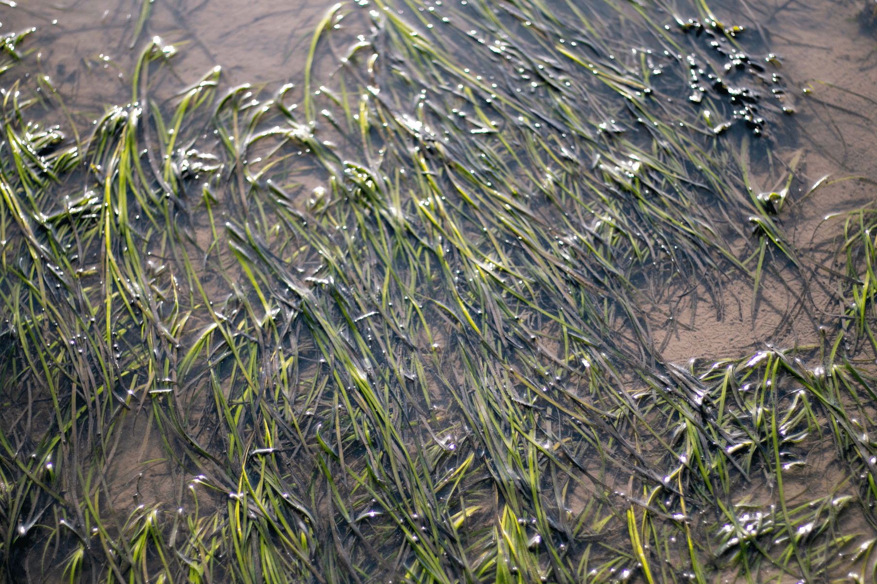
A seagrass meadow in Cardiff.

Previously undocumented seagrass meadow found in Cardiff’s Severn Estuary

Field discovery reveals a healthy and apparently expanding seagrass meadow in one of the UK’s most challenging estuarine environments  Marine conservation organisation Project Seagrass has found a previously undocumented intertidal seagrass meadow in Cardiff, within the Severn Estuary. The newly discovered meadow, which was found by Project Seagrass’ Chief Conservation Officer Dr Benjamin Jones, does

Read More »
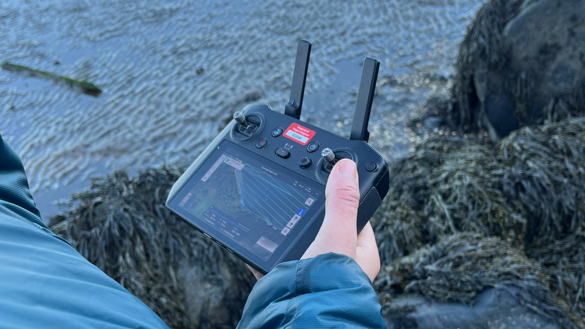
Drone controller being used next to kelp bed

Accelerate Seagrass Drone Survey

Accelerate Seagrass is a collaborative program being delivered by Climate Impact Partners, Deloitte, Project Seagrass, and the National Oceanography Centre which aims to support groundbreaking research into seagrass carbon sequestration and unlock long-term finance to save and reinstate vital seagrass meadows.   Part of this programme of work includes mapping to record the presence and extent of

Read More »
SeagrassTools Logo

Introducing SeagrassTools: strengthening the link between data and decision-making

July marks the launch of SeagrassTools, a single unified suite for seagrass science, conservation, and management which will enable users to collect, download, analyse, and act on seagrass data more effectively than ever before.  The new digital suite, which integrates citizen science, ecological data, restoration experiments, and spatial analytics, will support evidence-based decision-making across the full seagrass conservation cycle.  Seagrass ecosystems are among the most valuable yet threatened marine habitats globally. They provide critical ecosystem services, including carbon sequestration, fisheries support, and coastal protection. Yet despite their importance, monitoring and management efforts are often constrained by inconsistent data collection methods, limited integration between datasets, and barriers to analysing and interpreting ecological indicators. SeagrassTools has been developed in direct response to these challenges.  Seagrass spatial data from the Maldives uploaded to SeagrassTracker Enhalus acoroides seagrass sighting uploaded to SeagrassSpotter Effective seagrass conservation requires coordinated data collection, standardised metrics, and accessible tools that bridge science, practice, and community engagement. SeagrassTools brings together four complementary platforms – SeagrassSpotter, SeagrassRestorer, SeagrassViewer, and SeagrassTracker – into one integrated digital suite that connects data collection, analysis, visualisation, and restoration planning for seagrass ecosystems. SeagrassSpotter: A global citizen science platform for recording seagrass observations. It enables users to upload georeferenced images, contributing to large-scale datasets on seagrass distribution and condition. SeagrassRestorer: A platform hosting global seagrass experiments and attempts, acting as a decision support tool for planning and evaluating restoration interventions, incorporating ecological data to improve restoration success. SeagrassTracker: A monitoring tool designed to host seagrass spatial data and used to track changes in seagrass ecosystems over time, supporting adaptive management and impact evaluation. SeagrassViewer: A visualisation interface for exploring spatial seagrass data. It supports interpretation, communication, and decision-making. By unifying tools across the conservation pipeline, SeagrassTools reduces barriers to analysis, improves data interoperability, and enhances the ability to scale impact.   Seagrass conservation requires coordinated global effort. SeagrassTools provides the infrastructure to support that effort—connecting people, data, and decisions. We call upon researchers, conservation practitioners, policymakers, managers, citizen scientists, and communities alike to explore the tools, contribute data, and support the protection and restoration of seagrass ecosystems worldwide.  Explore SeagrassTools

Read More »
A seagrass meadow in Cardiff.

Previously undocumented seagrass meadow found in Cardiff’s Severn Estuary

Field discovery reveals a healthy and apparently expanding seagrass meadow in one of the UK’s most challenging estuarine environments  Marine conservation organisation Project Seagrass has found a previously undocumented intertidal seagrass meadow in Cardiff, within the Severn Estuary. The newly discovered meadow, which was found by Project Seagrass’ Chief Conservation Officer Dr Benjamin Jones, does not seem to appear in existing Natural Resources Wales records or available habitat maps. The site has now been mapped and will be shared with the relevant agencies so that it can be added to the evidence base for Wales’ coastal habitats. The two newly mapped patches of seagrass cover close to 1,000 m² in total. While this figure may sound small in a world of large conservation targets, this is a particularly significant find in this part of the Severn Estuary. The meadow sits within one of the most physically dynamic coastal environments in the world, shaped by the second largest tidal range on Earth and exposed to a complex mix of pressures from climate change, coastal squeeze, degraded water quality, historic contamination, industrial influence, and coastal development. In that context, nearly 1,000 m² of living seagrass in Cardiff is promising news. Dr Jones said: “Finding this meadow was a genuine bucket list moment. I have worked on seagrass for years, but I have never found a meadow that nobody seemed to know was there. Yes, it may be small in global conservation terms, but it does not feel small when you are standing there looking at it in the Severn Estuary. Most importantly, it is now on the map.” The meadow is made up of eelgrass, or Zostera marina, a species of seagrass found around the UK coastline. On the evening the meadow was found, the plants appeared healthy with seed and flower laden shoots visible. Zostera marina seagrass meadow discovered in Cardiff The two newly mapped patches of seagrass cover close to 1,000 m² in total. Examination of available satellite imagery suggests that the seagrass meadow has been present since at least 2006 and has increased in size over time. However, it was only possible to recognise those faint historical signs once the meadow had been found in the field and its location was known. Dr Jones said: “We do not yet know the full story of this meadow. The satellite imagery helps us look backwards, but only because we knew where to look. What matters now is to verify the record, monitor the meadow, and understand whether this is persistence, recovery, expansion, or something linked to nearby restoration activity.” This new finding highlights how easily small coastal habitats can remain hidden until someone sees them on the ground. Citizen scientist initiatives such as SeagrassSpotter have an important role to play in this mapping, encouraging the public to upload their seagrass sightings and contribute to a growing dataset mapping the World’s seagrass. The finding comes at a time of growing interest in seagrass conservation, restoration and recovery across Wales and the wider UK. For over a decade, Project Seagrass has been working to conserve and better understand seagrass habitats across Welsh waters and globally, including in the Severn Estuary, where restoration is challenging but important for nature recovery. The Severn Estuary faces a difficult environmental future. Rising sea levels and stronger storms are increasing flood and erosion risks, while natural habitats such as mudflats and saltmarshes are increasingly squeezed against hard coastal infrastructure. Water quality remains a major concern, with pressures from sewage discharges, nutrient runoff, agricultural pollution and wider catchment impacts. Historical industrial activity has also left a legacy of contaminants in parts of the estuary. Against that backdrop, the presence of a healthy, reproductive and apparently expanding intertidal Zostera marina meadow in Cardiff is a reminder that nature can still surprise us. This discovery does not mean the estuary is free from pressure or that recovery is guaranteed. It does however highlight why local observation remains an essential part of marine conservation. “There are still meadows out there waiting to be found,” said Jones. “Sometimes conservation starts with noticing what others have missed. This meadow is now visible. That gives us the chance to learn from it, monitor it, and hopefully protect it.” Project Seagrass will now work to verify the record, share the mapped data with relevant agencies, and continue monitoring the site to understand its condition, persistence, expansion and possible relationship with wider seagrass recovery in the Severn Estuary. You can upload your seagrass sightings to SeagrassSpotter.
Read More »
Drone controller being used next to kelp bed

Accelerate Seagrass Drone Survey

Accelerate Seagrass is a collaborative program being delivered by Climate Impact Partners, Deloitte, Project Seagrass, and the National Oceanography Centre which aims to support groundbreaking research into seagrass carbon sequestration and unlock long-term finance to save and reinstate vital seagrass meadows.   Part of this programme of work includes mapping to record the presence and extent of Scotland’s seagrass meadows (vital data to inform the protection and conservation of seagrass meadows and the benefits they provide). In autumn 2025, members of our Scotland team were out in the field carrying out drone surveys in Drum Sands.  In this blog post, our Project Seagrass interns, Ewan Garvey and Jasper Brown discuss the work undertaken: 1.Preparing to Monitor Prior to the commencement of drone work, site assessments were conducted. These checked for air restrictions, site accessibility, and permissions required to access land. Drum Sands (see below map), is a site we have recently mapped and is located within a private estate, requiring permission for access to get to and work on site. This site is located just outside of Edinburgh airport’s no fly zone, a restricted air space which must be kept clear of, at all times. 2. On Site After arriving at the site, we had to transport the kit and get it set up for flying, This included: a Differential Global Positioning System (DGPS), Ground Control Points (GCP’s) and the drone itself. The DGPS is a device which communicates with satellites and allows for extremely accurate spatial referencing of points, down to 3cm variance. The benefits of this system are to allow you to return to the exact location for continuous monitoring. GCP’s were positioned along the sample area. These are large checkered squares which are easily identifiable from the air. The exact locations are taken using the DGPS, to allow for the drone images to be synced to monitoring data. The drone was set up following our pre-flight checklist, ensuring the batteries, cameras, and propellors, were all in working condition. 3. Flying Once the drone had been launched and was in the air, the operator or another team member had to maintain line of sight with the drone at all times. This was to ensure the safety of others and the drone. At Burntisland, another of our sites, this was extremely important, as there is a railway line which runs adjacent to the seagrass meadow. We were given explicit instructions from Network Rail not to fly above the railway line, to avoid any disruptions to their services. Using a pre-programmed flight plan (below) the drone was set on course, taking images with a 75% overlap between images.The flight height was fixed at 60m. This was chosen to provide adequate clearance from the tops of trees and to increase the field of view. Once the flight plan was complete, we checked the images to ensure that the entire area we needed had been surveyed. 4. Challenges One of the biggest hurdles we faced during this drone work was weather; for good quality drone work to take place there must be clear, dry skies with low wind speeds. This was particularly inconvenient for us, as during our planned drone flights at Drum Sands, there were strong winds and rain, which meant that we were unable to fly the drone. Requesting for an extension of site access posed quite a challenge to do last minute but we managed to gain access to complete the work. While the drone was in flight the team had to keep vigilant for potential hazards such as flying birds and members of the public. We did this by having team members stationed along the sample locations. Each team member was provided with a radio to relay important information back to the pilot. This also allowed us to interact with any interested members of the public whist keeping the drone in sight at all times. 5. Wrap up and final product Once all the drone work had been completed, the images captured by the drone were exported and processed using specialised software, to remove the overlap between photos and to merge the separate images into one large map of the whole area. Using other data points gathered from the area we can overlap these and the image to create an easily understood map. We used this method to create the map (see below) which shows Zostera noltii transplant and donor DGPS points, overlayed onto the drone footage we took of Drum Sands.

Read More »